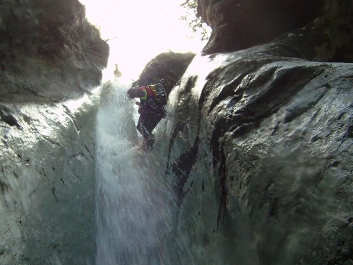
Rio Barbar
Description:
A short canyon that meets the rio Lavarie. As an alternative to the classic route, this canyon has remained unexplored. It is considered as an
alternative and more structured access point to the rio Lavarie as it contains 7 waterfalls, rather than the 2 in the classic route.
Rio Barbar then leads into the spectacular final sequence of pitches in rio Lavarie. Clearly, this route involves the second part of
rio Lavarie. Therefore, please see the relevant
description for information that is omitted here.Zone:
Friuli Venezia Giulia - Venzone (UD)Elevation:
Entrance: 410 mHeight difference: ~ 60 m
Length: 250 m
Highest pitch: 18 m
Advised decent period:
From May to OctoberExposure:
WestTiming:
Approach: 20'Descent: 1h to the confluence with the rio Lavarie
Return: Please see the description for rio Lavarie
Shuttle:
Approx. 5 KmAnchors:
SufficientAdvised ropes:
2 of 50 m + 1 of 20 m + emergency ropeGear:
Full wetsuit, bolting kitEscapes:
It is possible to climb up the banks of the canyon in several pointsMap:
Carta Tabacco 1:25000 page n° 020 - Prealpi Carniche e Giulie del Gemonese or n °018 - Alpi Carniche orientali Canal del FerroInterest:
LocalDifficulty:
V3 a2 III (rio Barbar only; see description for rio Lavarie)Coordinates (WGS84) for downstream (valley) parking:
Please see the description for rio LavarieCoordinates (WGS84) for upstream (mountain) parking and access point of the path:
Please see the description for rio Lavarie (lower part)Coordinates (WGS84) of the riverbed access point (start of canyon):
-Approach to the valley (lower car park):
Please see the description for rio LavarieApproach to the mountain (upper car park):
Please see the description for rio Lavarie (lower part)Approach to the canyon (walking) and technical notes:
Before the bridge over the rio Lavarie, on the left, there is an obvious path that is closed by a metal bar that leads into the forest (ProCanyon trail),
and this leads to the rio Lavarie stream bed after a few minutes.Here there are the remains of an old bridge, where a path leads into the forest on the opposite side of the river bank. Continue along this path, cross over two small streams, after which the canyon can be seen in the riverbed, and is easily reached by leaving the path and cutting down through the trees. This walk takes about 20 mins from the car.
01 - NA 4 R
02 - P 13 R
03 - P 17 (5+5) L
Canyon opens, some downclimbs
04 - NA 9 L
05 - P 9 R
06 - P 18 L
07 - P 18 (6+6) L
Confluence with the rio Lavarie
Exit:
Please see the description for rio Lavarie (lower part)Notes:
First descent was on the 24/07/2004 by Maurizio Biondi, Erwin Kob, Francesco Berti, Cristiano Massoli, Emanuele Bena, Natale Amato and Gianluca Serangeli.URL:http://www.canyoneast.it
Layout, design & revisions © 2017, CanyonEast Canyoning Team - Seba Broili, Vanessa Johnston, Romy Siegl, Cristian Vogrig
Webmaster: uomonero@canyoneast.it - Revised - - 22/08/2017
Layout, design & revisions © 2017, CanyonEast Canyoning Team - Seba Broili, Vanessa Johnston, Romy Siegl, Cristian Vogrig
Webmaster: uomonero@canyoneast.it - Revised - - 22/08/2017


