 |
 |
 |
 |
Rio di Bueda

Description:
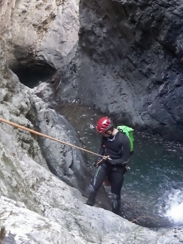
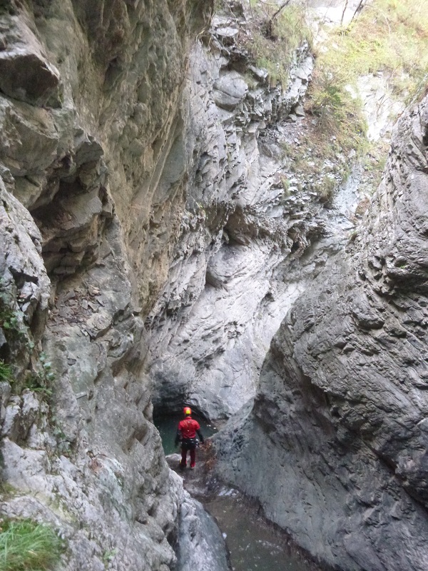
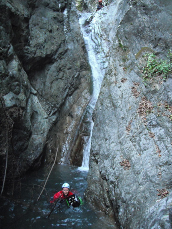
This route generally has a low flow rate and is developed in a green environment that is shaded in the beginning and final sections, while in the middle section
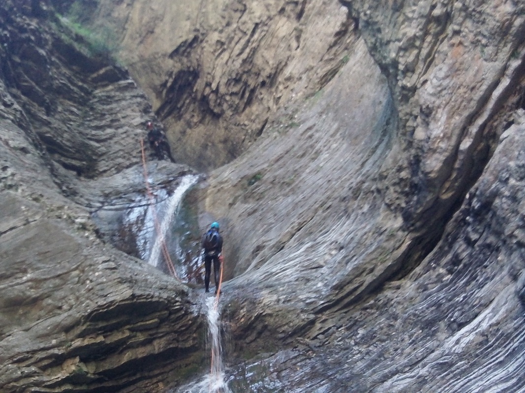
forms a beautiful meander between very characteristic rock layers, best seen under the sun. The pitches are not high but they are all beautiful. There are also a couple of jumps that prelude the pair of pitches separated by small pools that form the most characteristic section of the canyon.
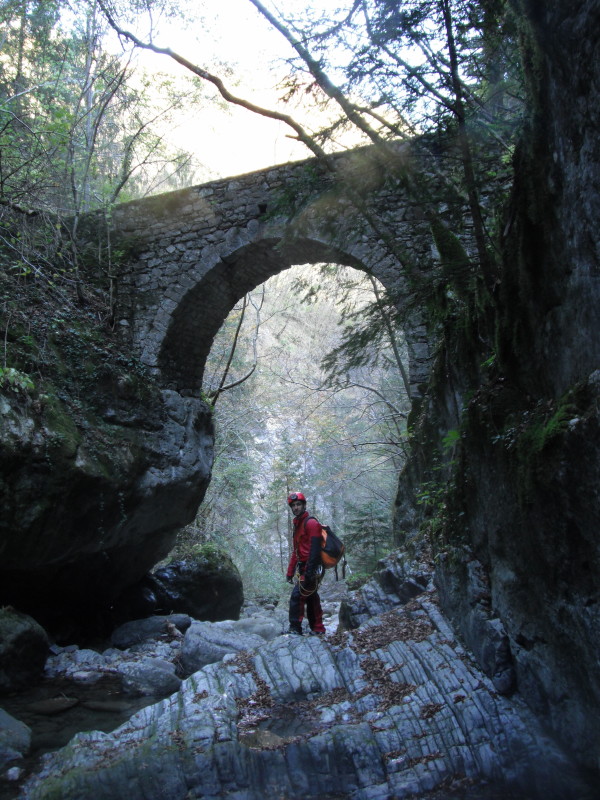
Of additional interest, towards the end of the route you pass under an ancient Roman bridge.
This canyon presents no highly technical difficulties but is worth visiting, also given the comfortable access and exit routes. Before starting the descent you should ensure that there is sufficient flow.

Zone:
Friuli Venezia Giulia - Zuglio (UD)Elevation and length:
Entrance: 800 m Exit: 450 m
Height difference: 350 m
Length: 1600 m
Highest pitch: 15 m
Advised decent period:
From April to OctoberExposure:
South-eastTimings:
Approach: 10 mins Descent: 3h 30 'moins
Return: 10 mins
Shuttle
3,4 KmAnchors:
ExpeditionAdvised ropes:
1 of 40 m + emergency ropeGear:
Full wetsuit, bolting kitEscapes:
At the Roman stone bridge (about three quarters along the descent) onto CAI footpath n° 162. Map:
Carta Tabacco 1:25000 foglio n° 09 - Alpi Carniche Carnia Centrale or n° 013 - Prealpi Carniche - Val TagliamentoInterest:
LocalDifficulty:
V3 a3 IVCoordinates (WGS84) for downstream (valley) parking:
46° 27' 52,1" N 13° 1' 11,7" ECoordinates (WGS84) for upstream (mountain) parking:
46° 28' 12,1" N 13° 0' 21,6" ECoordinates (WGS84) of the riverbed access point (start of canyon):
46° 28' 9,4" N 13° 0' 0" EApproach to the valley (lower car park):
From Tolmezzo, follow the SS52bis towards Arta Terme. After 7 km, turn left towards Zuglio and past the bridge over the River But. Turn right and follow the
signs to Fielis. Continue for about 500 m and park your car in a small clearing (3 cars) just after the bridge over the Rio Bueda.Approach to the mountain (upper car park):
Continue along the road towards Fielis for about 3.5 km until you reach the first houses of the village. Immediately before the village, at the last curve to the
right, there is a dirt road (banned to traffic - "divieto di transito") that is the approach path to the canyon.At the curve there is enough space to park the shuttle car; alternatively you can park a little further on in the village square.
Approach to the canyon (walking):
Follow the dirt road for about 10 minutes, at the point where this approaches the stream (on the right bank) you can easily reach the riverbed.Description and technical notes
You walk in an open environment for about 300 m, then you reach the first pitch01 - P 12 R
02 - NA 8 L (by-passable D 4 R)
Some passages of downclimbing
03 - P 8 Central
04 - P 10 R
Continue with some downclimbing for 100 m
05 - P (6+4) Central (the second pitch of 4 m can be descended as a toboggan)
06 - P 15 R
Continue with some downclimbing for 100 m
07 - P 15 R
Roman bridge, escape route to CAI path n° 162
08 - P 7 L/ T 6
09 - D 6 L (old water capture)
10 - P (7+3) L (Attention: bolts on water capture structure)
11 - P 12 L (Attention: bolts on water capture structure)
Exit:
After the last pitch, continue along the riverbed until you reach a weir. From here, take the path on the right bank that leads to a ford of the river near the
valley parking.Notes:
The first descent was made by F. Cacace and Co.Beware that the bolts are exploratory (multi-mounts of 6 mm with two chain links), some are connected with rope and a metal ring.
For a post-canyon refreshment, we recommend the Bar Stella just before the valley car park; great hospitality and affordable prices.
URL:http://www.canyoneast.it
Layout, design & revisions © 2017, CanyonEast Canyoning Team - Seba Broili, Vanessa Johnston, Romy Siegl, Cristian Vogrig
Webmaster: uomonero@canyoneast.it - Revised - - 22/08/2017
Layout, design & revisions © 2017, CanyonEast Canyoning Team - Seba Broili, Vanessa Johnston, Romy Siegl, Cristian Vogrig
Webmaster: uomonero@canyoneast.it - Revised - - 22/08/2017


