 |
 |
 |
 |
Rio Frondizzon 

Description:
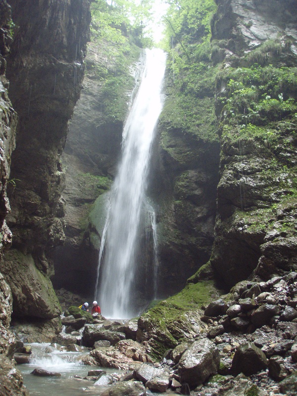
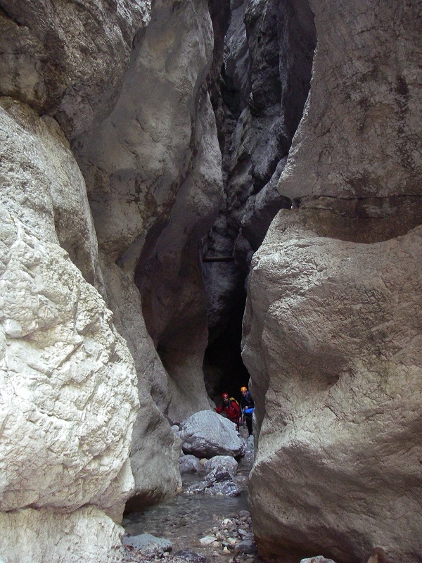
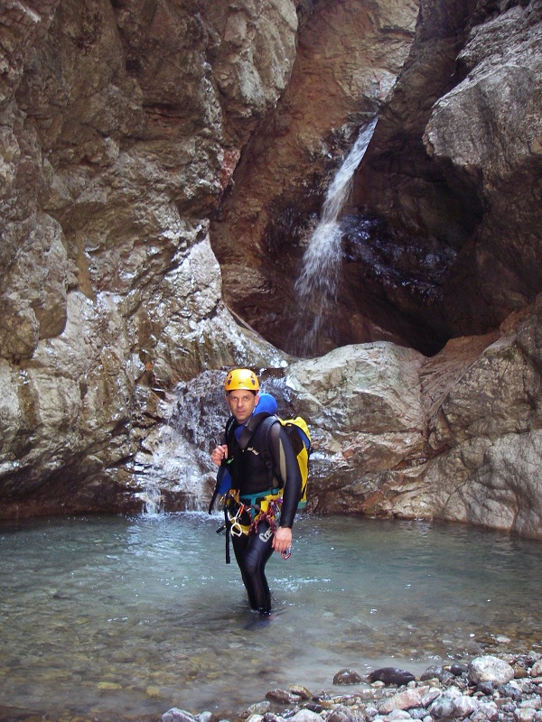
Short but interesting canyon, varied and fun. Its attractiveness is that within in a short distance a good variety of situations are met: the high waterfall with
considerable flow, the flat and relatively open section, a dark narrow meander, and some jumps and toboggans.
Zone:
Friuli Venezia Giulia - Tolmezzo (UD)Elevation and length:
Entrance: 550 mExit: 365 m
Height difference: 185 m
Length: 2000 m
Highest pitch: 33 m
Advised decent period:
From May to OctoberExposure:
North - NorthwestTimings:
Approach: 20 mins / 40 mins Descent: 2h 30 mins
Return: 0 mins
Shuttle:
No / 11 kmAnchors:
Excellent ProCanyonAdvised ropes:
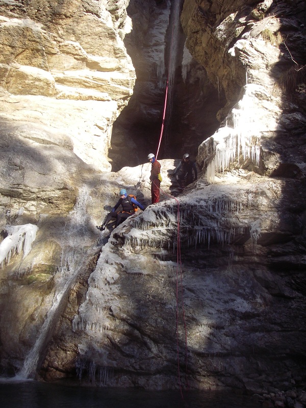
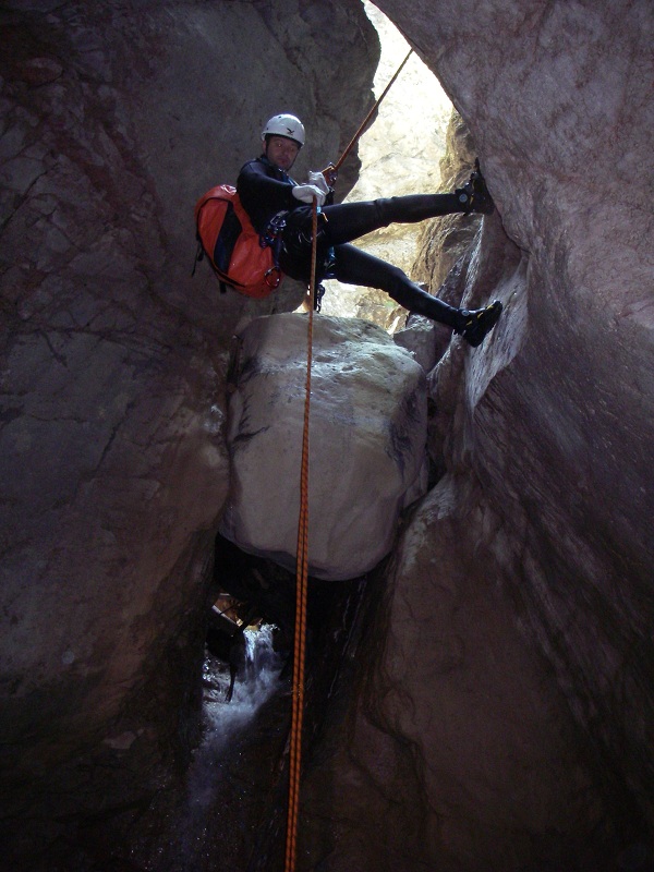
2 of 40 m, or better, 1 of 60 m + 1 of 20 m + emergency ropeGear:
Full wetsuit Escapes:
NoMap:
Carta Tabacco 1:25000 foglio n° 013 - Prealpi Carniche Val TagliamentoInterest:
RegionalDifficulty:
V4 a2 IIICoordinates (WGS84) for downstream (valley) parking:
-Coordinates (WGS84) for upstream (mountain) parking:
-Coordinates (WGS84) of the riverbed access point (start of canyon):
-Approach to the valley (lower car park):
From Tolmezzo take SS52 bis towards Nord / Passo Monte Croce Carnico. Pass the prison on the left, and continue on this state road for about 3 km. Turn right
into a lane just before a left-hand curve on the state road (between mileage signs IV-3 and V-3). Park near the power plant.Approach to the mountain (upper shuttle car park):
Go back and take the SS52 bis towards Tolmezzo. Exit the flyover following signs to Tolmezzo (traffic police), take Via Piave, then turn right at the roundabout
(signposted Cavazzo Carnico). After about 700 meters, turn left following the signs for Illegio. Continue straight, passing through a roundabout to a stop.
Continue straight towards Illegio. At the village, take the road on the left that goes slightly downhill between the houses, passing a high-tension pylon on the
left, and shortly after, near the church, turn left. Continue to the left (signed Pieve di S.Floriano) and after a few meters take a narrow downhill road to your
left that leads to the cemetery. Park the car at the cemetery and walk down the easy path (marked ProCanyon) until you reach the riverbed.Walk along the riverbed for about 1 km in an open and uninteresting environment. In the middle of this section you meet the uptake of water company ENEL, which can be by-passed on the right bank with an easy downclimb or on the left bank along the concrete walkway.
Approach to the canyon without shuttle (walking):
Behind the power plant, across the river, a path starts immediately to the right of the artificial tunnel crossed by the intake of the power plant (signed with
ProCanyon marks). Further along the path you enter into a rocky channel (which corresponds to the output of the artificial tunnel) and from there continue along
the flat path alongside the tributary (Rio Trambe).After a few minutes, you reach the catchment area of the power plant, and from there take the orographic left bank past the weir (metal ladders) and continue up the mountainside in a larch forest.
Follow the ProCanyon trail until you crossover the crest of the slope and then continue down the other side of the slope for about 50 meters until you reach the riverbed.
Description and technical notes:
The first pitch you meet is the highest and most demanding of the canyon; the (non-shuttle) ProCanyon trail leads directly to this pitch, whereas the shuttle
access forces a tedious walk of about 20 minutes in the riverbed.01 - MC + P 33 L
02 - P 8 R
03 - MC + P 10 L
04 - MC + P 12 L + DEV R
05 - MC + P 10 L
Exit:
After the last pitch and a short walk, exit on the right bank before the bridge to reach the power station and the car.Notes:
In this canyon, more than ever, it is the flow of water that determines the difficulty. In this regard, its classification is therefore difficult because the
canyon is easy with limited flow, rather difficult with average flow, and becomes fatal if full flow. Also consider the fact that after the narrow meandering
section, the canyon receives additional flow emitted by the catchment area of ENEL (left bank) and the flow rate can be significantly increased by the water
supply of this tributary. In the event that the catchment area is saturated, the flow observed in the first part of the canyon can be doubled after the confluence
with the tributary.The first descent was made in June 1996 by some members of the "Commissione Tecnica Forre del CNSAS".
URL:https://www.canyoneast.it
Layout, design & revisions © 2017, CanyonEast Canyoning Team - Seba Broili, Vanessa Johnston, Romy Siegl, Cristian Vogrig
Webmaster: uomonero@canyoneast.it - Revised - - 22/08/2017
Layout, design & revisions © 2017, CanyonEast Canyoning Team - Seba Broili, Vanessa Johnston, Romy Siegl, Cristian Vogrig
Webmaster: uomonero@canyoneast.it - Revised - - 22/08/2017


